
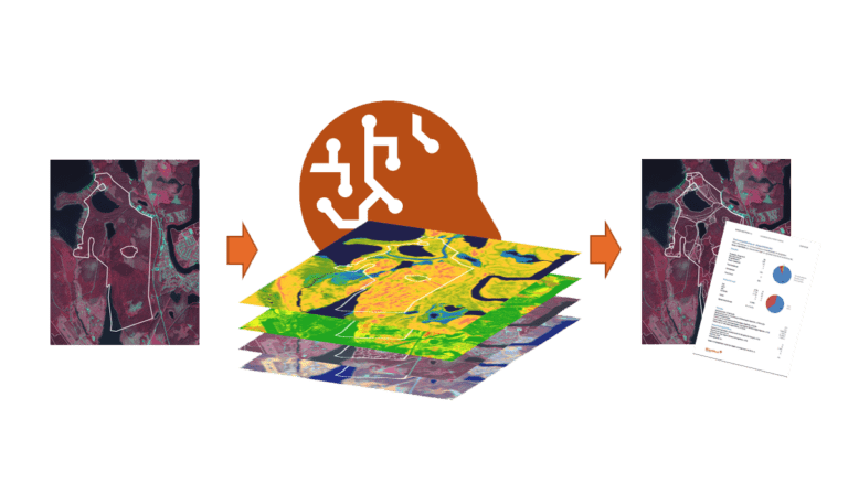
Forest Maps, Skogskartor in Swedish, is a SaaS service that divides an arbitrary geographical area (usually a forest property) into different types of land and, for forest land, into different forest stands or compartments. For each stand, a stand description is compiled and calculated, consisting of, among other things,
- Timber volume
- Tree species mix
- Height
- Site index
- Basal area
- Average diameter.
In addition, proposals for thinning and clear cutting measures are calculated.
The service also has functionality for updating the stand delineation, taking into account the executed measures so that they are reflected in the description. Additionally, there is logic to handle the section numbering to ensure it remains as stable as possible over time.
A service for every forestry organisation
Dianthus Forest Maps is very flexible in its use. As usual, the imagination sets the limits, but here are a few examples:
For large forest owners with existing registers, it can be used to achieve consistent descriptions and forest variables across large areas, for example, if you need to review the existing division with perhaps too large forest stands. Or if you intend to acquire new properties and want an updated description of the upcoming acquisition. Our functionality to take into account executed measures helps you catch up with any lagging maintenance.
As a timber purchasing organization, the service can be used to offer existing and future wood suppliers a forest management plan as a bonus. Its design allows for modern integration with existing systems and portals, so no new system is needed. Or why not map all the forests within your purchasing area for scouting and proactive market development?
If you work with logging/tract planning, the service can be part of a pre-planning process in the office, where you practically get a description of the intended action in smaller parts, providing a perfect basis for field visits and becoming efficient in the forest.
And much, much more. Feel free to book a meeting with us at Dianthus, for further discussion.
Updated data at your control
The service consists of a wide range of features that make it possible to combine control over what happens with the description of your own forest while constantly receiving current remote sensing data and the best calculations.
You can perform an annual projection or a complete update where the service divides and estimates the forest land based on new data and/or calculations. However, some objects (typically restrictions in various forms) need to be more or fully stable over time, which the service takes into account. The same applies to executed actions, where you often have better and more current geometry from the actual implementation that the service considers.
It is also possible to lock individual borders if needed, which are left untouched during an update. In fact, it is even possible to perform geometry edits using the service if necessary, a significant plus for minimizing the risk of corrupt data, lockouts, or other issues that easily arise in distributed systems.
Dianthus Forest Maps is therefore a rich toolbox of tools ready to be built into apps or large planning systems.
Are you a private forest owner?
Even you as a private forest owner can benefit from the service, as you can order a forest management plan for your property. Forest consultants who provide plans and advice to private forest owners can, of course, also use the service to extract a fresh forest management plan and, based on that, add their own value. In total, this is much more cost-effective than traditional forest management planning, which in itself is very labor-intensive for data that can be just as easily estimated with our service.
Under the Hood
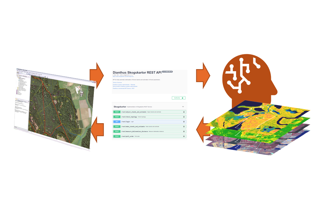
The service is implemented as a so-called REST API, which makes it easy for another system to communicate with the service. The customer’s system submits an area (e.g., property or logging tract), and after a short while, the service responds with delineated forest stands with up-to-date forest descriptions.
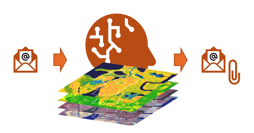
As a private forest owner, all you need to do is send an email, and we’ll take care of the rest. 😉